Governing urban lands from the bottom down – Subsurface inclusion in spatial planning
When thinking about underground development and planning, mainly in the urban space, there are certain international cases that come to mind. Singapore is one example, with its underground master plan that includes a digital twin benchmarking study that provides the context and tools for integrated subsurface planning. Singapore has also amended its Lands Bill and the Land Acquisition Bill (2015) to facilitate long-term planning and development of the subsurface (McNeill, 2019). Further examples include Hong Kong and its long-term strategy to cavern development (Ho et al., 2016), and Helsinki, with its urban underground master plan (Vähäaho, 2016). Beyond these prominent cases, however, many cities are in more nascent stages in terms of developing and governing underground spaces. In Sweden, for example, there are emerging opportunities in terms of how underground governance considerations are being actively adopted by various municipalities in the country.
One of the key intentions of the research project UNDER is to create methods or approaches that are meaningful for underground governance purposes. As a parallel to the relatively more well-established concept of ecosystem services (Costanza et al., 2017), UNDER aims at supporting the systematic inclusion of geosystem services in spatial planning processes. Geosystem services generally refer to the contributions to human well-being from goods and services derived from the abiotic (Gray, 2011) or subsurface (van Ree & van Beukering, 2016) structures and processes (Lundin Frisk et al., 2022). Some services are well-known and acknowledged in spatial planning, for example: 1) the subsurface as a medium to build and construct in and/or on; 2) physical space for underground constructions and infrastructure, 3) groundwater, energy and material extraction; and 4) storage use ( e.g., water, energy and carbon dioxide) (Lundin Frisk et al., 2022). Others are less tangible, for example: 5) habitat provision for ecosystems and support for surface life; and 6) serving as an archive of cultural and geological heritage (Van Ree and Van Beukering, 2016; Lundin Frisk et al., 2022).
A complete view on geosystem services (Lundin Frisk et al., 2022) is often lacking in physical planning practices and decision-making processes of the subsurface. Often, the underground is shaped by a “first come, first-served” principle, i.e., the first claim to access the subsurface is accepted without a thorough investigation of possible alternative subsurface uses (Volchko et al., 2020; Norrman et al., 2021a), whereby subsurface challenges are only limited to the immediately obvious ones, like underground space competition. UNDER, as a project, intends to support addressing the invisibility of geosystem services in spatial planning processes, with an aim of developing methods or approaches that help planners identify and acknowledge geosystem services as an opportunity to integrate sustainable and socially just subterranean developments in urban areas.

As the UNDER team, we believe that there are some urban needs that can be addressed through a geosystem services framework and thinking with the underground as a planning dimension.
The importance of governing the subsurface and geosystem services
Multiple species thrive in urban areas, particularly within urban green spaces, delivering vital ecosystem services to urban dwellers. This has positive implications for human health, wellbeing, and quality of life within the urban setting. However, green areas are almost always subordinate to the monetary values of land and its uses. Thus, greening tends to take place in areas not suitable for other purposes, such as roof tops, and roadsides highly congested with infrastructure. Land availability for the development of urban green spaces is referred to as one of the main challenges for greening the city (Kabisch et al., 2016). The desired tree-cover that provides shade and protects surface life from heat highly depends on the subsurface space availability for trees’ rooting. The space required for tree rooting and access to the water table is, in many cases, already occupied by cables, pipes, and other critical urban infrastructure. Geosystem services like habitat provision, retention of water in soils, soil development, and regulation of soil chemistry (Lundin Frisk et al., 2022) are vital as they form the basis for primary production of green spaces and provision of ecosystem services. Admittedly, land perceived in 2D – length and width – can hinder efforts to increase the city’s resilience to the ongoing societal and environmental challenges, like the provision of shade through tree canopy. In contrast, land perception in 3D – length, width, depth – allows for expanding the possibilities of the urban beyond the surface.

Climate change poses unprecedented challenges for humans and the environment. Examples are increasing heatwaves, prolonged periods of drought, higher frequency of so-called 100-year rainfall events, increased storm frequency and intensity, and rising sea levels. Underground functions, both naturally occurring and human-made, are essential for the city to cope with such threats. The intrinsic ability of the subsurface to buffer and store water, isolate and keep stable temperatures, and provide shelter can contribute to both adaptation and resilience to climate change. Indeed, most of the essential infrastructure to retain water to move within the city also rests on the use of natural subsurface structures and processes. These valuable subsurface contributions can be regulation of baseline and extreme events, flows of water, and regulation of the hydrological cycle (Lundin Frisk et al., 2022). During long periods of drought, the groundwater and the subsurface ability to store and filter water will be essential for city functionality and well-being.
Storms and heavy rains cause floods and runoffs that can destroy and damage buildings, as well as undermine infrastructure and endanger people. This is exacerbated by the paving of the ground that leads to a decreased provision of such geosystem service as the regulation of groundwater quantity hinders the natural buffering and filtration capacity of soils. Thus, it is imperative to reserve areas for the infiltration of stormwater and to de-seal the already paved surface. Using underground space for cisterns is an alternative geosystem service. Globally, the sinking of cities due to soil subsidence is happening faster than the rising of sea water level (e.g. Waltham, 2002).
Developing underground spaces tends to have high levels of permanence in the built environment (i.e., they are not easily removed) and therefore they need to be carefully planned, designed and implemented, considering future (multipurpose) uses and functions. Planning the third dimension that captures urban undergrounds in spatial planning processes allows for some sustainable and resilient strategies. The UNDER team believes that a wider consideration to geosystem services and the implementation of tools to map these services can enhance their potential and benefits for humans and non-humans.

Considering societal relations in urban underground planning
When thinking about undergrounds and their services, it is essential to think about the relations between the surface and subsurface, especially how this relationality affects surface social lives (Norrman et al., 2016). There is a tendency to think about these dimensions – surface and subsurface – as separate, or to favour surface understandings. This is particularly present in terms of how underground spaces and their services are owned, managed, and acknowledged – mainly in two ways, as spaces of technological development and as containers of waste and discarded materials.
Underground development has privileged technical decision-making processes, limiting the inclusion of social inputs into the potentials of its development. Increasing collaboration between technical expertise and inviting beneficiaries to be part of the inception and design of the project are relevant aspects in designing spaces that are inclusive and that provide services beyond the intended main purposes (i.e., mass transportation), exploring the urban underground as spaces of opportunity. The challenges of working with the underground do not only relate to the complexities of identifying geosystem services and their benefit for humans and non-humans. Nor it is only about developing tools and mechanisms so that they work seamlessly with surface planning, despite the clear need to do so. Working, thinking, and planning with the underground present us with the opportunity of including long term desires of a more just and liveable city for all.
For long, we have actualized the subsurface as the space where we hide unwanted infrastructures and activities so that the city may continue to grow, with high technical expertise and with limited input from communities. Undergrounds have become spaces of abandonment and contamination, darkness and pollution, of infrastructure congestion and space competition, containers of waste and discarded objects. This utilitarian perspective can be challenged by thinking more with what the subsurface in connection with the surface, with the connections that geosystem services bring to the human relations with the underground.
Discussing urban land without considering the underground is increasingly difficult, especially as we face the challenges of planning cities in the context of climate change. Even when not fully acknowledged, the subsurface – including its materials and the functions it supports (geosystem services) – informs how cities grow and develop (von der Tann et al, 2021). Perceived as scarce on the one hand and opening for further expansion on the other, the underground is a political and economic space that is increasingly impacted by competition, infrastructure legacies and environmental challenges (Connor, McNeill, 2020). Current interventions in the subsurface tend to fall in the technoscientific domain, usually disengaged from their social, environmental, political, and economic implications (Melo Zurita, 2020). Geosystem services could act as a framework to help develop governance tools that consider underground planning and its implications. We also believe that the geosystem services approach gives us the tools and the opportunity to think beyond the technical, not only in terms of the cultural heritage of undergrounds, but by imbuing the design of these spaces with notions of accessibility for all, intergenerational benefits, and potential use as public spaces. Taking care of available geosystem services underneath cities only increases liveability, activating lands beyond their surface opportunities. Understanding this connectivity can support a change in how underground spaces have been conceptualized so that they become spaces that support (urban) life.
References
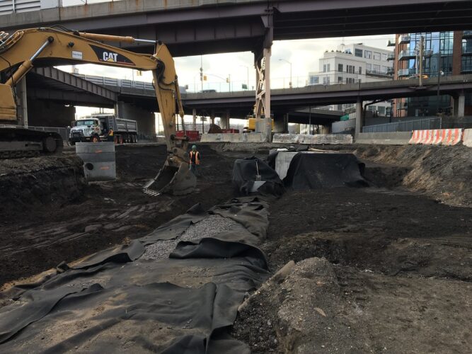
Cover image: “Backfilling detention pipe trench east of Thomson Avenue in Long Island City, Queens. (CQ033, 11-15-2017)” by MTA C&D – EAST SIDE ACCESS is licensed under CC BY 2.0.
Admiraal, Han, and Antonia Cornaro. “Why underground space should be included in urban planning policy–And how this will enhance an urban underground future.” Tunnelling and Underground Space Technology 55 (2016): 214-220.
Connor, Andrea, and Donald McNeill. 2022. ‘Geographies of the Urban Underground’. Geography Compass 16 (1): e12601. https://doi.org/10.1111/gec3.12601.
Costanza, R., de Groot, R., Braat, L., Kubiszewski, I., Fioramonti, L., Sutton, P., Farber, S., Grasso, M. 2017. Twenty years of ecosystem services: How far have we come and how far do we still need to go? Ecosystem Services 28, 1-16.
Gray, M. (2011) Other nature: geodiversity and geosystem services. Environmental Conservation 38, 271–274. https://doi.org/10.1017/S0376892911000117.
Ho, Y. K., Shum, K. W., & Wong, J. C. F. (2016). Strategic use of rock caverns and underground space for sustainable urban development of Hong Kong. Procedia engineering, 165, 705-716.
Kabisch, N., Strohbach, M., Haase, D., & Kronenberg, J. (2016). Urban green space availability in European cities. Ecological indicators, 70, 586-596.
Lundin Frisk, E., Volchko, Y., Taromi Sandström, O., Söderqvist, T., Ericsson, L. O., Mossmark, F., Lindhe, A., Blom, G., Lång, L.-O., Carlsson, C., Norrman, J., 2022. The geosystem services concept: What is it and can it support subsurface planning? Ecosystem Services 58, 101493. https://doi.org/10.1016/j.ecoser.2022.101493
Lundin-Frisk, Emrik (2023). Geosystem services to support decisions on subsurface use (Chalmers University of Technology: 2023:1) [Licentiate thesis, Chalmers University of Technology]. Chalmers University Publications Electronic Archive.
McNeill, Donald. “Volumetric urbanism: The production and extraction of Singaporean territory.” Environment and Planning A: Economy and Space 51.4 (2019): 849-868.
Melo Zurita, Maria de Lourdes. 2020. ‘Challenging Sub Terra Nullius : A Critical Underground Urbanism Project’. Australian Geographer 51 (3): 269–82. https://doi.org/10.1080/00049182.2020.1723829.
Norrman, J., Volchko, Y., Hooimeijer, F., Maring, L., Kain, J-H., Bardos, P., Broekx, S., Beames, A., Rosén, L., 2016. Integration of the subsurface and the surface sectors for a more holistic approach for sustainable redevelopment of urban brownfields. Science of The Total Environment, 563-564, pp 879–
Norrman, J., Ericsson, L., Nilsson, K., Volchko, Y., Sjöholm, J., Markstedt, A., and Svahn, V., 2021a. Mapping subsurface qualities for planning purposes: a pilot study. IOP Conference Series: Earth and Environmental Science. 703 012011.
Norrman, J., Ericsson, L.O., Markstedt, A., Volchko, Y., Nilsson, K.L., Sjöholm, J., 2021b. New dimensions in Swedish planning – an investigation of subsurface planning and geosystem services. BeFo Report 214.
https://www.befoonline.org/publikationer/r–214__2384
Vähäaho, Ilkka. “Development for urban underground space in Helsinki.” Energy Procedia 96 (2016): 824-832.
van Ree, C.C.D.F. and van Beukering, P.J.H. (2016) Geosystem services: a concept in support of sustainable development of the subsurface. Ecosystem Services 20, 30–36. https://doi.org/10.1016/j.ecoser.2016.06.004.
Volchko, Y., Norrman, J., Ericsson, L.O., Nilsson, K.L., Markstedt, A., Öberg, M., Mossmark, F., Bobylev, N. & Tengborg, P., (2020) Subsurface planning: Towards a common understanding of the subsurface as a multifunctional resource. Land Use Policy 90, 104316. https://doi.org/10.1016/j.landusepol.2019.10436.
Von Der Tann, L, N Metje, B Collins, and M Melo Zurita. 2021. ‘A Perspective on the Governance of London’s Subsurface’. IOP Conference Series: Earth and Environmental Science 703 (1): 012020. https://doi.org/10.1088/1755–1315/703/1/012020.
Waltham T., 2002. Sinking cities. Geology Today, 18 (3), pp. 95 – 100. DOI: 10.1046/j.13652451.2002.00341.x