Thick Mapping and the Local History of Urban Regeneration in North Belfast
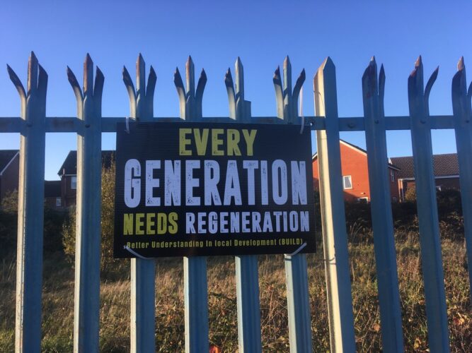
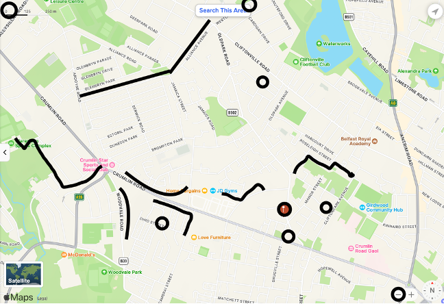
The Oldpark Carnegie Library in North Belfast has been closed since 2010, but is currently being brought “back to life” as part of a community-led regeneration initiative. The library stands in a part of Belfast with a history of intense violence during the conflict, and the local area remains particularly fractious, with numerous “peace walls” and active interfaces. Here, segregated communities fear losing ground in the peace process[1] and territorial contests are rife. Ongoing divisions have made it difficult to rebuild this part of the city (both in relational and material terms) and previous attempts at urban regeneration have left long-term memories of spectacular failures and partial successes, which now fuel both hopes for the future and fear of disappointment. Any projects of regeneration therefore must stay alive to the many contested meanings and needs projected onto them as well as into the peace process in general. Methodologically, this makes Oldpark Library difficult to place. In this brief research paper, I suggest a version of thick mapping methodology (Cuff et al 2020) to survey different layers of meaning, time, data, history, voice, and experiences (ibid., 105–106). In other words, rather than attempting to get closer and closer to the essence of a place, this approach stacks different kinds of maps to chart contested territory. The strength of starting from a particular type of building (in this case a library) and a particular type of process (community-, rather than government- or commercially-led regeneration) is that it can elicit different types of sources, more complex chronologies of conflict, and local experiences of peacebuilding. The mapping I have slowly been assembling makes use of the library’s own records, local North Belfast newspapers, successive regeneration policies for North Belfast, and interviews with former librarians and library users as well as current developers and community workers. Each of these sources maps the library, the surrounding area and community, and recent history in particular ways. Together, they demonstrate how North Belfast is drawn together in separate and overlapping geographies and communities of memory, which allows us to tell a more integrated but no less contested local history of peacebuilding and regeneration.
More than a library
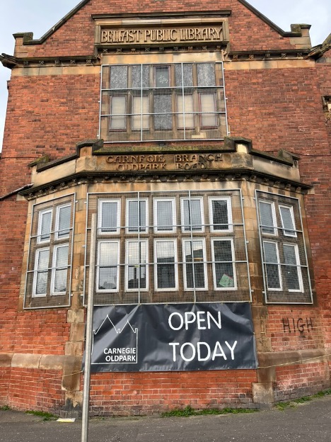
Although the inscription stone on the building says “Belfast Public Library”, the Oldpark Library has also housed a number of other functions. Since the mid-1990s, the actual book-lending library has retreated to one front room, consigning the rest of the space to other activities and organisations. The old lending library at the back of the building was taken over by a youth club in 1994, and in the mid to late 2000s, the upstairs “Juvenile Room” and “Magazine Room” were repurposed for the Upper North Belfast Community Empowerment Partnership (UNBCEP). The “library” still holds records and ephemera of all these activities, but they are no longer bound up with any existing administration. During the peace process, the building has slowly been abandoned by authorities as youth and library services have been discontinued and funding for community projects has been relocated. The papers and traces left behind now constitute what I call a “vernacular archive”: a documentary and ephemeral archive which gives access to a very particular place, period, and people in high resolution detail. It is from these sources that I begin the thick mapping of the building, how it stands in relation to its environment, and the history of regeneration in North Belfast.
Mapping policy and community with a vernacular archive
Under the stairwell, in what used to be the men’s room in the library, I have found the papers of the Upper North Belfast Community Empowerment Partnership (UNBCEP). These papers chart a particular time and place in North Belfast, as well as a very local perspective on the ways in which policy and community compose each other.
The UNBCEP existed from 2004 to 2011 and was headquartered in the Oldpark Library. It drew together territorially disconnected Protestant community groups from Ballysillan to Lower Oldpark, from Torr Heath to Woodvale, to provide a point of engagement, network, and training and to “build a strong, attractive, stable and confident community” (DETI 2004, 3a). The papers contain descriptions of activities delivered under EUs “Urban II” programme, which guided and funded “the economic and social regeneration of cities and neighbourhoods in crisis in order to promote sustainable urban development” from 2000 to 2006 (EUR-Lex n.d.). In Northern Ireland the funding was earmarked for North Belfast, “[T]o regenerate North Belfast into a vibrant, safe and viable urban community for its people, its environment and its economy” (Carson and Pidgeon 2010:6). Going through the many folders, binders, and boxes of the UNBCEP, it becomes more and more obvious that the “post-conflict” peacebuilding work they have been doing has been completely bound up with successive regeneration policies. From the “Making Belfast Work” initiative launched in 1988, to the 10-year UK-wide “Neighbourhood Renewal” strategy launched in 2003, North Belfast has been an ongoing target for local and national government policies to “build rapport between communities [and] reduce political and sectarian tensions” and “improve the quality of life for those living in the area” (DfC, n.d.). Oldpark Library is now a site of pending regeneration, but is clearly also already a site shaped by previous efforts at regeneration.
North Belfast is often called the seismic area of Belfast with its “[…] complex series of ever-changing interfaces and spatial juxtapositions” (Shirlow and Murtagh 2006, 61). However, it is also a shapeshifter in administrative terms. North Belfast has several different electoral geographies: one for Westminster Elections and Northern Ireland Assembly Elections, and another for City Council elections. The boundaries drawn for constituencies and wards of course bear consequences for how political communities (and electoral majorities) are assembled and represented. In the same vein, regeneration policies map out different publics and territories, depending on what scale of government and what model of governance they rely on. EU funding, which has fueled many regeneration and peacebuilding activities in North Belfast, is based on a partnership approach in which city councilors and the private and voluntary sectors collaborate to deliver services. The partnership model relies on the participation of and collaboration with local community groups, which in turn requires high levels of organised community identity. Effectively, this means that policies at once rely on and constitute “local communities” through their catchment areas and objectives. In Northern Ireland, the term “community” has predominantly been used to refer to Protestant and Catholic parts of the population, and improving relations between the “two communities” has been a fundamental building block since the outbreak of conflict in the late 1960s (Dunham 1972). In this context, it is important to remember that communities are not exclusively based on shared identity, tradition, and political ideology, but also come into their own as place-based policy communities.
In the papers of the UNBCEP (the “Upper North Belfast” of its organisational name itself another geographical part of the sum) it is clear how the different policy and funding frameworks structure their activities and the people and areas that can be engaged with them. The policy frameworks assemble North Belfast in a variety of ways: sometimes they observe, respond to, and undergird existing territorial identities and at other times they try to integrate, override, or transcend community lines of division. Correspondingly, some UNBCEP activities are focused on “single identity work” in the so-called “PUL” (Protestant, Unionist, Loyalist) community spread out across the Oldpark district[2], and others are tied to cross-community work scaling the peace walls to the immediately adjacent Cliftonville and New Lodge. Here, urban regeneration and peacebuilding become inseparable practices, but the base and pace at which it should be delivered is an ongoing contestation of spatial and temporal frames at the local level. One of the main challenges for the UNBCEP is that they are trying to pull together small, fragmented, Protestant communities that may share an identity but are physically separated and so cannot benefit from the same solutions and services on the ground. When policy frameworks further separate them into geographically joined-up catchment areas, community work becomes about creating alternative maps and practices that continue to place them in relation to each other. As the headquarters of the UNBCEP from 2004-2008, the Oldpark Library was central to this mapping of disjointed Protestant communities onto each other. However, when the headquarters were moved to the nearby Spectrum Centre in West Belfast, it foreshadowed not only the final closure of the library services in 2010, but also the gradual disappearance of Oldpark on administrative maps.
The UNBCEP papers offer a hyper-local view of the hard work that goes into delivering very small-scale community services, like IT classes and job training, aimed at building confidence, particularly in young people. The many applications and evaluations of local activities portray a fractured Protestant working-class experience of being lost in transition. The programmes often centre on single identity-building “to make young people feel more confident in culture and beliefs” as a prerequisite to engage with others and the peace process at large. Importantly, the papers also show how the Loyalist feud[3] continues to create tensions and disconnects within the Protestant community, where some young people feel safer doing cross-community work than intra-community work.
Mapping the immediate history of regeneration through local newspapers
While the vernacular archive in the library gives us access to a partial view of how the Protestant community identity is gathered up in response to broader policy frameworks for urban regeneration, the local newspapers map out the broader contestations between Unionist and Nationalist areas of North Belfast in the competition for “peace dividends”.
Until 2013, North Belfast had two local newspapers: The Unionist North Belfast and Newtonabbey Herald and Post and the Nationalist North Belfast News. The way in which these local newspapers map out identity and belonging in North Belfast is a poignant example of the imagined community writ small. In the political and physical focus of their coverage, they each assemble otherwise territorially fragmented communities, whilst at the same time completely disassociating from areas (editorially as well as geographically) deemed to belong to “the other side”. They report not in sync, but in parallel spheres. Read together, the papers take in the separate and overlapping geographies of North Belfast and reveal the deeply local struggle over urban regeneration in Northern Ireland’s transition from war to peace.
During the conflict, North Belfast was home to a number of significant security installations like the Crumlin Road Gaol and the Girdwood Barracks army base. During the peace process, these have become important and contested sites of closure, redevelopment and regeneration. Both sites are immediately adjacent to the Oldpark Library and provide an urgent context for how the local community imagines the possibilities and pitfalls of regeneration projects and the physical and symbolic transformations of “the local community” that follow in their wake.
Conflicts over urban regeneration in North Belfast are bound up with territorial belonging and demographic developments. It is of course difficult to make comprehensive planning for an area that is so atomised, contested almost from street to street, but it is also a challenge that the Catholic part of the population is growing and increasingly feels boxed in, while the Protestant population is in decline and feels crowded out. Many regeneration projects launched during the peace process have tried to open up and de-territorialise localities in order to create more “shared space”. However, if regeneration projects employ a conventional model of combining housing, leisure and retail (Neill 2004), the ground on which they stand may quickly become dominated by those who come to live there. Since Catholics have a greater housing need, Protestants fear new developments will effectively be re-territorialised.
In the local newspapers, there is a constant debate about who will benefit from regeneration projects, depending on where they are to take place. The debate around the redevelopment of the Girdwood site works to illustrate how the redistribution of spatial relationships in North Belfast is linked up to the overarching peace process.
Girdwood Barracks is one of those sites that exposes the deep differences of perspective and lived experience in North Belfast. When its closure was announced, Unionist politicians were angered on behalf of the local community in lower Oldpark (which the barracks bordered to), questioning their future security in a context where the IRA’s commitment to peace was continuously called into question (Sterling 2005). Nationalist politicians, on the other hand, warmly welcomed the 27 acres of land it would release, which could then be redeveloped into much needed social housing above the New Lodge (Sterling 2005b). In fact, expectations that the peace agreement would see the British army withdraw and all military installations be dismantled, meant that Nationalist politicians had called for the closure of Girdwood Barracks since 1998 (NBN 1998). When the final closure was announced in 2005, the North Belfast News ran a double spread article titled “Girdwood – Base of Brutality” which began with the paragraph: “For three decades the installation was the focal point of a reign of terror inflicted on the Nationalist population of Belfast” and continued to run through all the forms of violence associated with the site. This ranged from illegal interrogation techniques during internment to fatal incursions into the local Nationalist community and collusion with Loyalist paramilitaries (McKernon 2005). While the elected Unionist representatives in North Belfast saw the barracks as a much-needed protective presence during the conflict, which was still crucial well beyond the peace agreement, the Nationalist community saw it as a centre of oppressive power during conflict and a barrier to necessary normalisation in the ongoing peace process. The dissonant interpretations, of the past meaning of the site, the present need for it, and its future use, are not surprising in the context of conflict, but also speak to very different temporal and visceral experiences and expectations of the particular transition in North Belfast. Nationalists are planning for future expansion and Unionists are worried about existing foundations.
It is important to note that the local newspapers do not report both of these perspectives, but only one side. The complete disassociation from the other community (in terms of covering stories in their areas and in terms of making it possible to understand their needs, interests, and positions) creates severe sinkholes in the mental maps of the population in North Belfast.
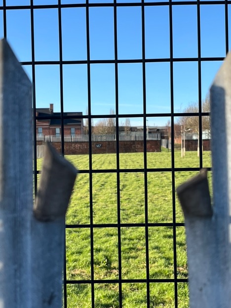
Girdwood opened as a shared “Community Hub” in 2016, with leisure facilities, meeting rooms, and sports grounds. It is accessible for both communities but is also a contact point for interface rioting (Belfastlive 2019). On the side directly facing Lower Oldpark, three sets of fences have been erected between the housing and the hub and there is a marked reluctance to cross the road and make use of the shared space, which is still considered to be unfamiliar and unsafe.
Mapping with contemporary stakeholders
The final map I will mention here involves the current stakeholders in the regeneration of the library and plots their plans and concerns for the space and surrounding community. After having been closed for five years, the Oldpark Library building was put up for auction in 2015. It was bought by the charitable Northern Ireland Foundation, with the intention to bring it “back to life” as a community resource. It has since become part of a heritage cluster in North Belfast that aims to deliver “[…]heritage led regeneration through making use of the area’s authentic character to support economic and social development” (https://greatplacenorthbelfast.com/). In this context, the one functioning room of the library has been opened up to two weavers and their looms and plans are being developed to make the first floor of the building into a “Centre for Weaving Excellence”. This leans into the Carnegie family history as well as the local linen history of North Belfast. Each of these projections captures and situates the building differently in relation to local, national, and transnational networks and contexts. The local Lower Oldpark Community Association, which is a main stakeholder in the regeneration project, represents the small, exclusively Protestant enclave that holds living memories of using the library and the youth club, and also of gradually losing the vital services and social infrastructure it provided. Their hopes for the project are first and foremost about what it can offer to the everyday life of residents in the immediate area, but also about preserving the building as a valuable container of their community history. For the charitable foundation that now owns it, it is about finding a meaningful and sustainable operating model, which entails drawing up a community that would need to extend beyond the surrounding streets and across the peace walls. The North Belfast Heritage Cluster places the building, not just in relation to an exclusive religious or political identity community, but in relation to other heritage assets at risk around North Belfast. Here, the community is made up of organisations that own or care for historic buildings and the focus is on creating a more confident sense of place through material history, concentrating on North Belfast’s diversity as a unique strength. If the library branched out and came to house a Centre for Weaving Excellence, that could mean joining up with actors in the textile industry across Ireland and Britain. The Carnegie legacy of course also links the library to the thousands of libraries that Andrew Carnegie endowed throughout the Anglophone world and to his vision of creating them as “Palaces for the People” (Klinenberg 2018).
As such, the building itself provides its own perspective and projection. As a former library, the building has instilled in it the idea of being a place with a low threshold for entry and a valuable gateway to learning and perspective. A public library is free, open for everybody, and gives access to technical, cultural, scientific, and practical knowledge without being part of formal education. It facilitates social life and interaction but may also shelter and nourish the individual imagination and body. All stakeholders recognise this embodied ideal of the building as a lodestar for any future regeneration, but questions remain about the scale of community at which this can be realised.
Each of these stakeholder perspectives map onto the building in different ways, placing it in relation to different publics, practices, possibilities, pasts, presents, and futures. However, it is still rooted in a disputed area.
As set out from the beginning of this article, the building stands on what continues to be an active interface, with all the complex problems that entails: sectarian tensions, high levels of deprivation, violence and intimidation, blighted spaces, restricted access to facilities and services, and impeded mobility (BIP 2011, 2017). The library sits directly in extension of the Lower Oldpark, the small Protestant enclave which is surrounded by peace walls on three sides, constantly wary about the dissipation of the local community. In a place where territory has been contested in terms of survival, and in an overarching process where the Protestant majority identity has become a minority identity, it will be far from straightforward to open up this space.
That the building has been bought with a view to benefit the local community, whilst also looking to open it up to a broader set of experiences, means navigating with several maps superimposed onto each other. The dual quality of the library at once standing territorially grounded – being unquestionably a local library – whilst also affording opportunities to build on different pasts beyond the immediately local and conflictual, makes it a very rich site for studying the affordances of thick mapping and the possibilities of regeneration.
Conclusion
Thick mapping allows us to see how North Belfast continues to be assembled through separate and overlapping geographies, not simply charting space, but actively shaping how peace, place, and possibility are lived and negotiated on the ground. It demonstrates how the urban landscape cannot be read through a single, flat lens, but must instead be understood through a layered approach—where official policy maps, administrative boundaries, mediascapes, vernacular archives, and lived experiences collide, contradict, and sometimes converge.
From the UNBCEP’s efforts to create relational space among territorially disconnected communities, to the contrasting editorial geographies of the local newspapers and the plans of contemporary stakeholders—each map drawn tells a different story of who belongs, who benefits, and who imagines a future here.
The Oldpark Library—once a civic institution and now a palimpsest of community uses—sits at the intersection of these overlapping maps. It is simultaneously a symbol of public retreat, a vessel of communal memory, a resource for regeneration, and a site of imaginative projection.
What thick mapping captures is not simply the spatial divisions of North Belfast, but the temporal, emotional and administrative investments layered into its transformation in the ongoing peace process.
NOTES
[1] Since the early 1990s, the term “peace process” has been used to describe an amalgamation of steps and movements to transform the conflict in and over Northern Ireland. The pivotal turning points were of course the paramilitary ceasefires of 1994 and the peace agreement of 1998, but the “peace process” refers to a broader and more incremental transformation of society, which is still ongoing. The peace process is challenged by the contradictory constitutional ambitions of Unionists (who want Northern Ireland to remain British) and Nationalists (who want Northern Ireland to be Irish), which continue to be played out as territorial and symbolic contests on the ground.
[2] The PUL moniker captures different emphasis of identity, where “Protestant” refers to religion, “Unionist” refers to constitutional allegiance to the United Kingdom, and “Loyalist” refers to being working class and at the brunt of violent conflict. The corresponding combination is CNR: “Catholic”, “Nationalist”, and “Republican”.
[3] There have been a series of feuds between the two Loyalist paramilitary organisations the Ulster Volunteer Force (UVF) and the Ulster Defence Association (UDA), with a particularly intense period between 2000-2001, where hundreds of families were intimidated out of their homes in West and North Belfast. The feud has left lasting legacies, not least in the shape of drawing lines between Protestant areas in West and North Belfast, where lower Oldpark has become firmly dominated by the UDA.
References
Belfast Interface Project. Belfast Interfaces: Security Barriers and Defensive Use of Space. Belfast: Belfast Interface Project, 2011.
BelfastLive. “Girdwood Hub Trouble Leads to United Call for Calm.” BelfastLive, October 2, 2019. https://www.belfastlive.co.uk/news/belfast-news/girdwood-hub-trouble-leads-united-17023546.
Carson, Jodie, and Colin Pidgeon. European Funding in Northern Ireland. Research and Library Service Briefing Paper NIAR 388-10. Belfast: Northern Ireland Assembly, 2010.
Cuff, Dana, Anastasia Loukaitou-Sideris, Todd Presner, Maite Zubiaurre, and Jonathan Jae-an Crisman. Urban Humanities: New Practices for Reimagining the City. Cambridge, MA: MIT Press, 2020.
Department for Communities. “Introduction: Neighbourhood Renewal.” n.d. https://www.communities-ni.gov.uk/articles/introduction-neighbourhood-renewal (accessed May 21, 2025).
Department of Trade and Investment (DETI). Memorandum. 2004. https://find-and-update.company-information.service.gov.uk/company/NI051702/filing-history?page=2.
Dunham, Arthur. “Community Development and Community Relations in Northern Ireland.” Social Service Review 46, no. 2 (1972): 155–69
EUR-Lex. “Urban II.” 2005. https://eur-lex.europa.eu/legal-content/EN/TXT/?uri=legissum:g24209&print=true.
Klinenberg, Eric. Palaces for the People: How Social Infrastructure Can Help Fight Inequality, Polarization, and the Decline of Civic Life. New York: Crown, 2018.
McKernon, Andrea. “Girdwood Base of Brutality.” North Belfast News, March 5, 2005.
Neill, W. J. V. Urban Planning and Cultural Identity. London: Routledge, 2004.
North Belfast News. “Crumlin Crucial to New-Look North Belfast.” North Belfast News, September 12, 1998.
Shirlow, Peter, and Brendan Murtagh. Belfast: Segregation, Violence and the City. London: Pluto Press, 2006.
Sterling, Mark. “Plans to Close Army Base Angers MLA.” Community Telegraph, March 2, 2005.